Profile
I hold a Bachelor's degree in Software Engineering and a Master of Philosophy degree in Information Technology from the University of Sindh Jamshoro. My professional journey began as a freelancer, where I developed desktop and web applications using modern .NET framework and PHP for a diverse range of clients.
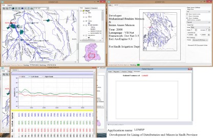
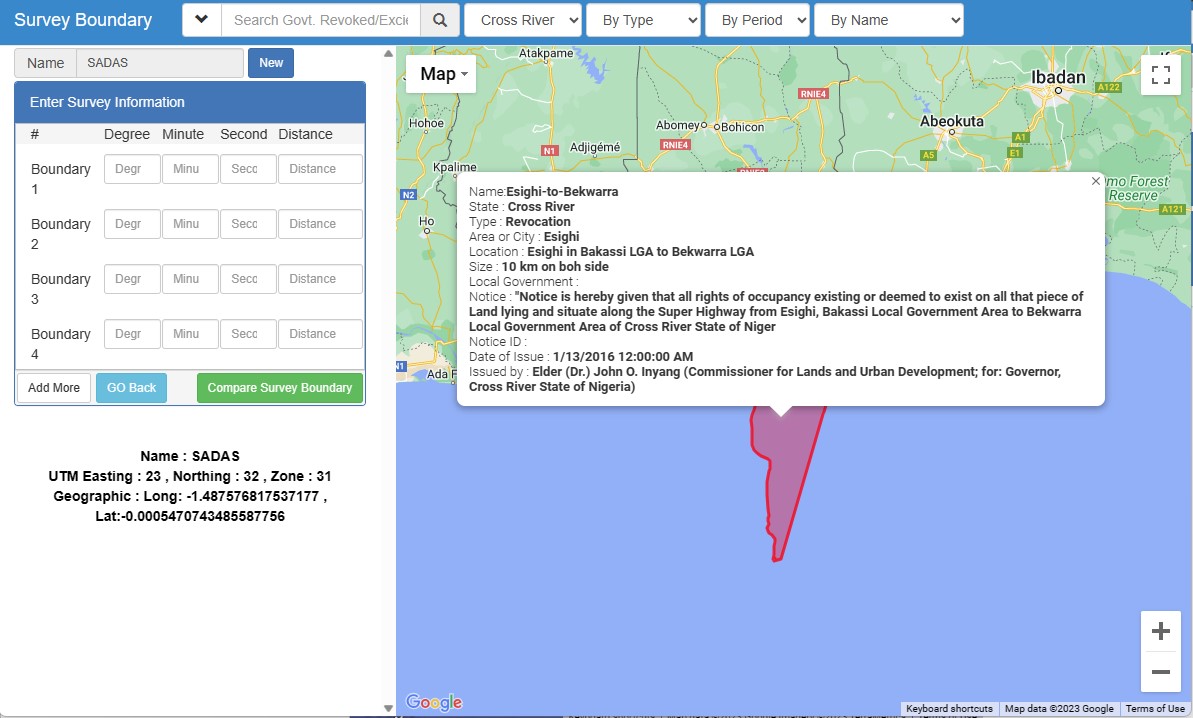
As my experience in development grew, I joined CSMS (Country Survey and Mapping Services (PVT.) LTD.) as a GIS Developer for the "GIS Development for Lining of Distributaries and Minors - Sindh" project, supported by Nespak (National Engineering Services Pakistan). In this role, I created a customized desktop GIS application using the ArcGIS Engine Development Kit. Additionally, I designed a database model that effectively connected non-spatial datasets with primary geospatial information.
As my experience in development grew, I joined CSMS (Country Survey and Mapping Services (PVT.) LTD.) as a GIS Developer for the "GIS Development for Lining of Distributaries and Minors - Sindh" project, supported by Nespak (National Engineering Services Pakistan). In this role, I created a customized desktop GIS application using the ArcGIS Engine Development Kit. Additionally, I designed a database model that effectively connected non-spatial datasets with primary geospatial information.
Currently, I have been promoted to the role of GIS Specialist at SIDA. In this capacity, I coordinate, plan, monitor, and supervise the potential adverse impacts and cumulative effects of ongoing project interventions on modern Geographic Information System (GIS) and Management Information System (MIS) technologies. Building upon my previous contributions, I have upgraded and integrated previously developed web applications into a centralized water information system, which is now hosted on the SIDA website. Throughout my professional tenure, I have actively participated in training workshops, acquiring comprehensive knowledge in the development sector. Moreover, I have been involved in reporting, research, event organization, and monitoring and evaluation activities.

GIS/MIS Specialist & Software Developer.
A results-oriented professional specializing in GIS mapping, software development, and project management, seeking a challenging position in a progressive organization. Committed to delivering excellence, driving innovation, and achieving success through strategic leadership and a strong desire to serve.
- Birthday: 4 June 1986
- Website: www.hala.pk/ibrahim
- Phone: +92 332 2966892
- City: Hala New, Sindh , Pakistan
- Age: 37
- Degree: M.PHIL (INFORMATION TECHNOLOGY)
- Email: ibrahimmemon5@hotmail.com
- Freelance: Available
Results-driven professional with extensive experience in GIS/Remote Sensing, utilizing Esri ArcGIS, Global Mapper and Google Earth Pro. Skilled in digital image classification, desktop/web mapping and proficient in programming languages such as C#, Python, Visual Basic, ASP.Net, PHP, JavaScript, HTML5/CSS. Proficient in database management, networking, and adept in software development environments and platforms.
Freelance Projects
Governemnt Projects
Contributions
Awards
Skills
Resume
Sumary
Muhammad Ibrahim Memon
With over 15 years of experience, I am an innovative and deadline-driven professional in GIS mapping and software development. I excel in GIS Mapping and creating user-centered software, taking projects from their initial concept to the final, polished deliverable.
- Amin Faheem Colony Dargha Road Hala New , Sindh
- (+92) 332-2966892
- ibrahimmemon5@hotmail.com
Education
PhD in Information Technology
2021 - InProgress
University of Sindh , Jamshoro , Sindh
Master of Philosophy in Information Technology
2016 - 2020
University of Sindh , Jamshoro , Sindh
Bachelor of Science in Software Engineering
2004 - 2008
University of Sindh , Jamshoro , Sindh
International Trainings & Workshops
Flow Measurement Techniques
05 - 11 February 2020
AIT Extension, Asian Institute of Technology, Thailand
Digital agriculture workshop
June 30 – July 7 ,2019
FAO (Food and Agriculture Organization) in China (Beijing-Wuxi-Hangzhou)
Regional Trainings & Workshops
Transforming the Indus Basin with Climate Resilient Agriculture and Water Managment
21-22 & 27-31 March 2023
FAO @ Islamabad , Pakistan
Groundwater Modeling and Big Data
14 – 18 March 2022
PCRWR @ Islamabad , Pakistan
Training Plan for Good Practices of Modern Control and Operation of Canals in Sindh
28 Feb – 04 Mar 2022
Irrigation Dept GoSindh
ACWA Design Sprint Workshop
09 – 10 December 2021
FAO @ Islamabad, Pakistan
Results Validation Workshop For Land Cover Mapping Of Pakistan And Training On Google Earth Engine (Gee)
07 – 08 December 2021
FAO @ Islamabad, Pakistan
Water Accounting Principles
25 February – 01 March 2019
FAO @ Islamabad, Pakistan
Geographic Information System (GIS) and Remote Sensing using ArcGIS 10.3
26 - 30 March ,2018
USPCAS-W Mehran University of Engineering and Technology, Jamshoro
Advance Hydraulic Modeling using HEC-RAS
January 11,2017
USPCAS-W Mehran University of Engineering and Technology, Jamshoro
Hydraulic Modeling using HEC-RAS
11 – 15 May, 2016
USPCAS-W Mehran University of Engineering and Technology, Jamshoro
Management of Irrigation and Agriculture System Geospatial Techniques
15th April, 2015
Institute of Space Technology
RS & GIS Applications in Flood Monitoring & Damage Assessment
19 – 23 December 2011
SUPARCO @ Karachi , Sindh
Career Certification
CCNA-Exploration: Network Fundamentals
2009 - Quaid-e-Awam University
SGA Computer Certificate for Programming - 2000
Awards & Performance Appreciation Certificates
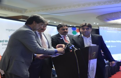
Irrigation Web Site
3rd August 2023
Mr. Murad Ali Shah former Chief Minister inaugurated new and updated web site of Sind Irrigation department, on that occasion Mr. Jam Khan Shoro, Former Minister Irrigation, Mr. Zarif Iqbal khero Former Secretary Irrigation Department and Mr. Muhammad Ibrahim Memon.
Flood 2022
Capacity Building Training conducted in ISRA University for fresh graduates
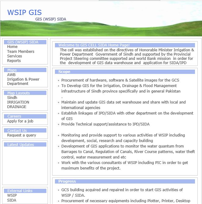
World bank funded - Water Sector Improvement Project 2019
LBOD Breach 2020
Flood 2011
Flood 2010
Professional Experience
GIS Specialist
2016 – Present
Sindh Irrigation And Drainage Authority
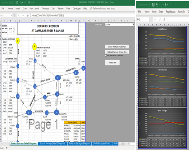
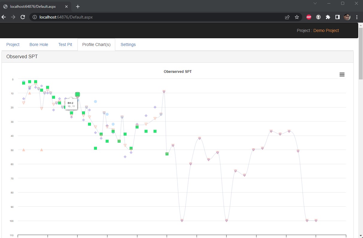
GIS Specialist Role is to combine spatial data with other information in order to create a better understanding of geographic phenomena. GIS Specialist is responsible for collecting, managing, analyzing, and displaying spatial data for a variety of applications, such as land use planning, Flood Mapping, Crop Assessment, and Automizationad Centralication of GIS information related to water sector. Addionnaly design and develop GIS applications, create programming code for existing GIS software, and develop new GIS tools integrating GIS with other computer systems and databases.key responsibilities as per SIDA Tors for overall development, monitoring and coordination of the position are mentioned as under
- Establishing the MIS/GIS data base and developing different GIS applications
- Liaison with national & international institutions for developing geo-spatial database, procurement of images & geo-referenced data.
- Presenting results of research at appropriate forum
- Understanding of geo-spatial technologies application especially in disaster risk management
- Digital image processing and classification skills
- Knowledge and skill in the operation of GIS equipment
- Statistical analysis and use of Remote Sensing for planning,
- Statistical analysis and use of Remote Sensing for planning,
- Support in establishment of telemetry system in irrigation system
Computer Programmer ( GIS )
April 2011 – September 2016
Sindh Irrigation And Drainage Authority
GIS programmer will provide development and support to an enterprise level Geographic Information System (GIS) Solutions. These Solutions are primarily focused on Irrigation and Drainage, but could include Land Management; Flood controls structure, transportation or any other
- Provide GIS new system development by using ArcGIS-9x including desktop and server environment, Arc Object, Python, SQL Server, VB.Net and Arc Pad.
- Develop the required GIS application, which can be capable of monitor the WSIP activities.
- Provide GIS service, such as may production, data support, analysis and reporting database management and publish in SIDA web portal page.
- Develop and administer data security and backups.
- Maintain secure user access to SIDA GIS data bases.
- Troubleshoot problems from user of corporate applications.
- Implement operating system, database and application upgrades.
- Acting as a liaison with internal and external data user and stakeholders to facilitate data sharing and distribution.
GIS Developer
August 2008 to Feb 2011
Country Survey and Mapping Services (Pvt.) Ltd.
- Development of custom GIS application using ArcGIS Engine 9.2
- Designed database model
- Developed modules for datagization, data entry of spatial as well as non-spatial data of canals, distributeris, minors, bridges, outlets, head regulators and other irrigation infrastructure.
- Developed a custom GIS application using ArcGIS Engine Development Kit and VB.Net.
Freelancer Work
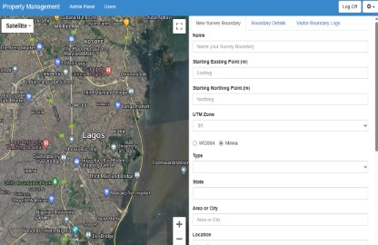
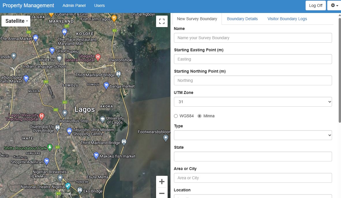
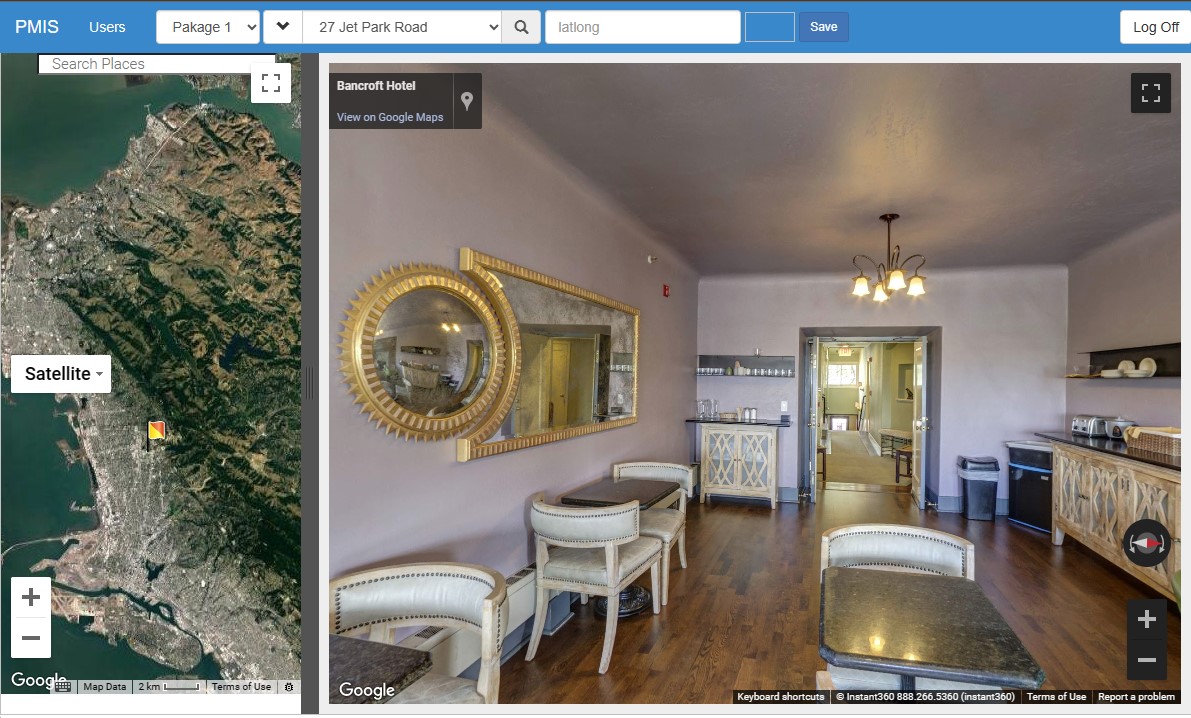
Nigeria Property Managment MIS/GIS Dashbaord
Designed and developed Borehole management information system for The Spatio.
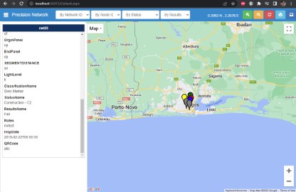
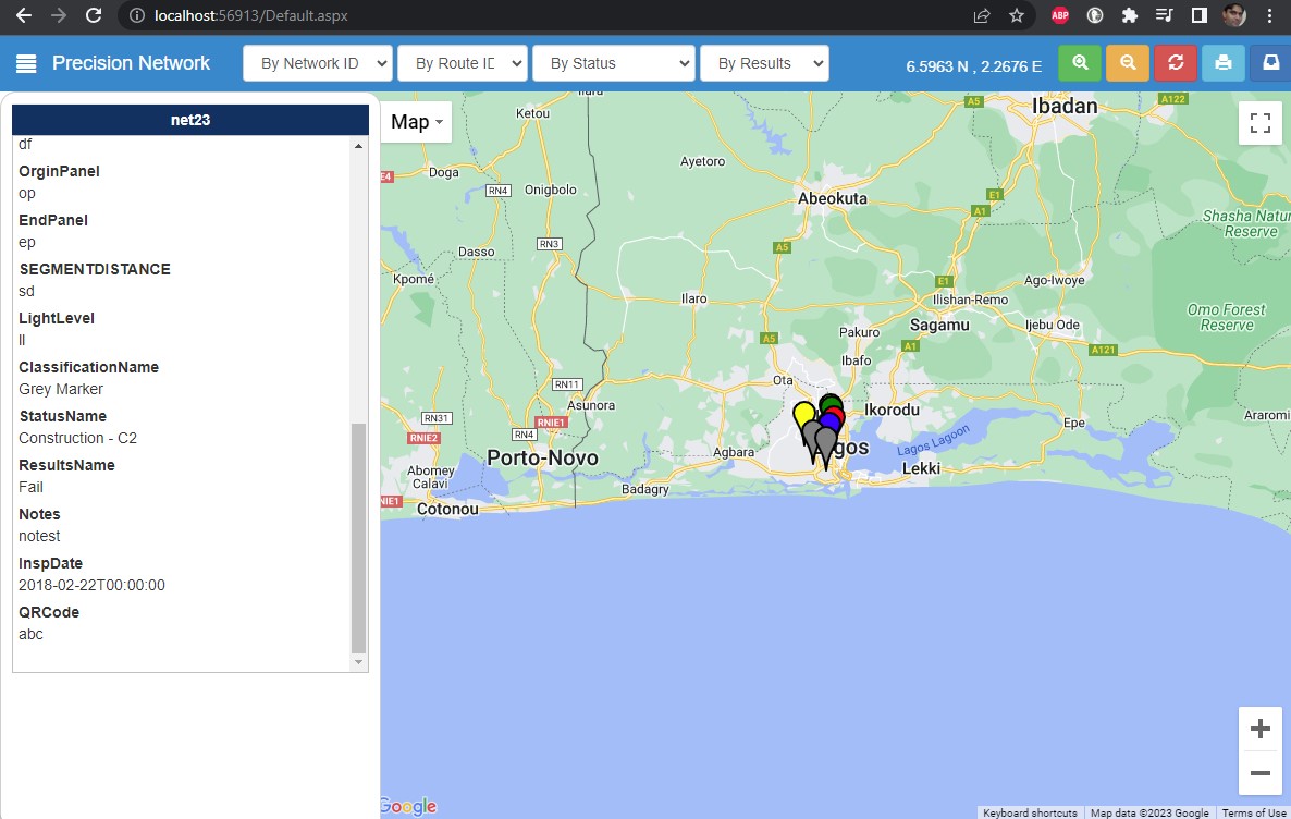
Nigeria Precision Network MIS/GIS Dashbaord
Designed and developed Precision tracking and mapping network services issues on gis dashbaord.
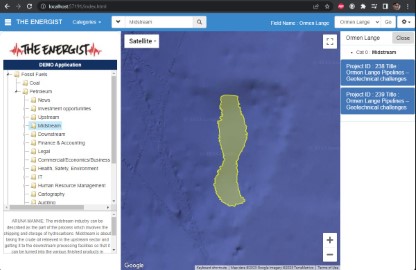
The Energist MIS/GIS System
Designed and partially developed The Energist's pertroleum and energy projects gis/mis infromation system.
SQUARE FOOTAGE CALCULATOR - ROOFNG TECHNOLGOIES
Designed and partially developed The Energist's pertroleum and energy projects gis/mis infromation system.
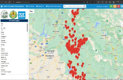
Basic Education Development Schools GIS Dashbaord
Designed and developed Basic Education Development Schools GIS Dashbaord - Azad Jammu & Kashmir.
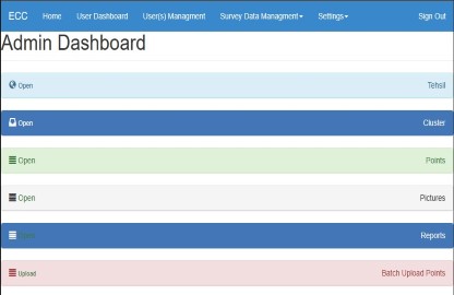
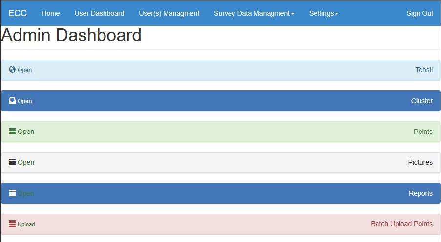
ECC MIS/GIS Survey Web Dashboard and Andorid Survey App
Borehole MIS
Designed and developed Borehole management information system for The Spatio.
Ufone Telecom ( Hala New Branch )
Designed and developed SIM Management Application for distribution and management of mobile phone sim among customers.
Warid Telecom ( Hala New Branch )
June 30 – July 7 ,2019
Designed and developed Financial Management Application for local customers billing at Warid Telecom Hala New branch office.
Contributions
Sindh.org
January 18, 2023
Former Chief Minister (CM) Syed Murad Ali Shah inaugurated library of eminent scholar and agriculturist late Muhammad Hussain Panhwar at M H Panhwar of Sindh Studies Jamshoro..
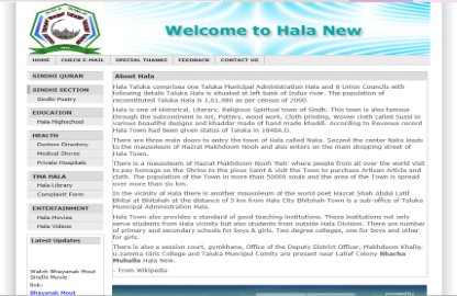
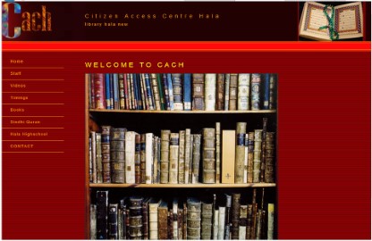
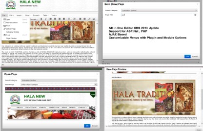
Hala.pk
Developed and maintaining home town website.
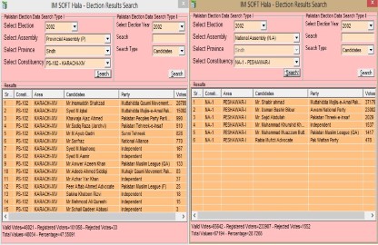
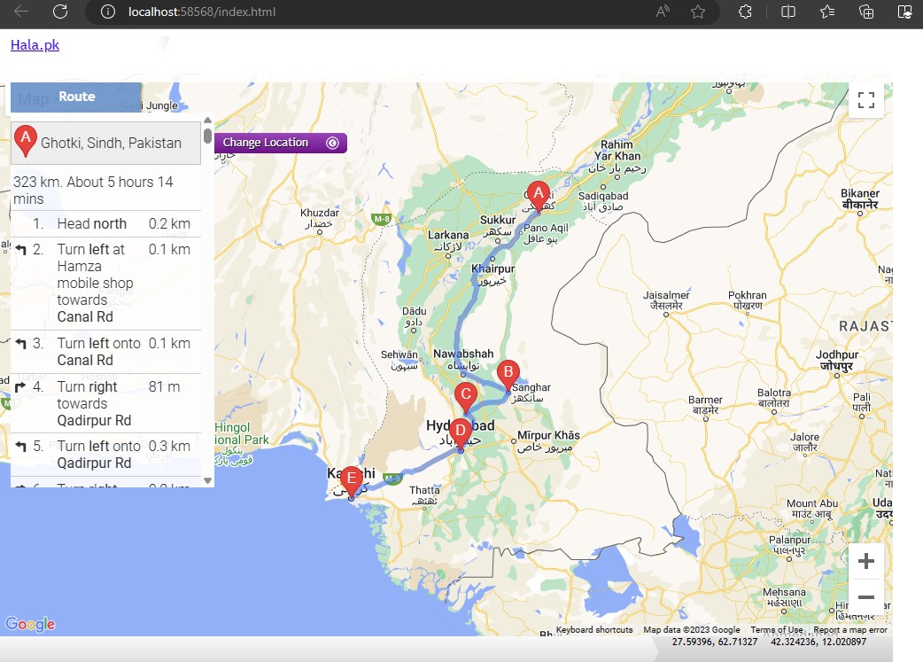
Route Plan Web App
Designed and developed route planning app.
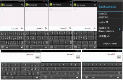
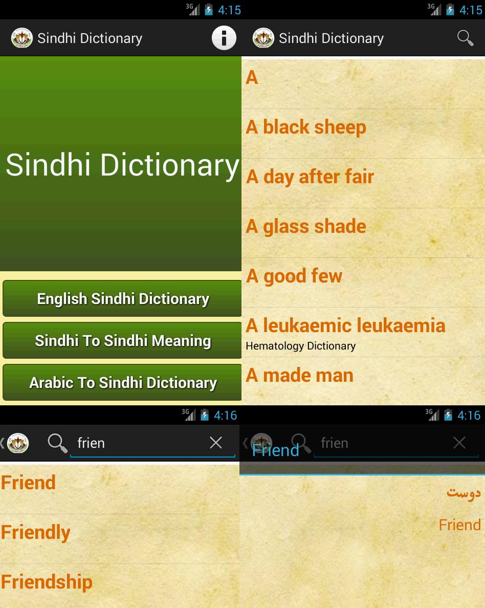
Android Sindhi Keyboard
Android Sindhi Dictionary
Portfolio
- Irrigation/SIDA
- Media & Appreciation
- Freelance
- Contribution
- Other Work


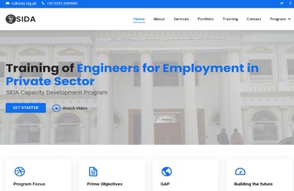
Training of Engineers Website
Training of Engineers for Employment in Private Sector web portal View Details


M. H. Panhwar Institute of Sindh Studies, Jamshoro
Fromer Chief Minister of Sindh Syed Murad Ali Shah inaugurated the personal library of the late M H Panhwar at the Muhammad Hussain Panhwar Institute of Sindh Studies in Jamshoro and also launched the precious books’ digitised library.
News


Testimonials

Imran Aness Memon
Ceo & Founder The Spatio
I had the pleasure of working with Ibrahim on complex GIS / software development projects and I can confidently say that their expertise and professionalism exceeded my expectations. From the very beginning, Ibrahim demonstrated a profound understanding of GIS principles and how to integrate them seamlessly into software solutions. and was able to provide innovative solutions to address the objectives of the projects. Based on my experience, I wholeheartedly recommend Ibrahim as a skilled and dependable software/GIS developer. His technical proficiency, GIS expertise and commitment to delivering high-quality solutions make him an invaluable asset to any team/organization.

Ghullam Murtaza
Ceo & Founder The SachalSoft
Highly skilled software developer with a deep understanding of programming languages such as C#, PHP, and Javascript. Their expertise, attention to detail, and commitment to delivering exceptional results make them an invaluable asset to any software development team.

Serfraz Almani
Ceo & Founder BBI
Versatile and highly skilled, this professional excels in GIS mapping, software development, and project management.
Contact
Location:
Amin Faheem Colony Dargha Road Hala New , Sindh
Email:
ibrahimmemon5@hotmail.com
Call:
+92 332 2966892